Habitat Modeling
The Georgian Bay Land Trust is leading work to update eastern Georgian Bay’s ecosystem mapping. This includes comprehensively mapping key habitat types and their relationships with each other, as well as their position within the current network of protected areas and existing and planned human development. These maps can be compared with the habitat requirements of individual species at risk to identify which pieces of land are most likely to support target species.
When they are complete, these maps will feed into a digital biodiversity atlas accessible to everyone making planning decisions in the area. They will allow users to look at any individual piece of land, understand its ecological role and the species it likely supports, and see how it ranks in terms of conservation priority within the landscape. Most importantly it will show how important habitats are connected and rank the importance of those connecting areas. The mapping will analyse and rank areas of greatest risk to biodiversity such as proximity of high value wetland complexes to roads and spread of invasive species such as phragmites into these. This will provide municipalities, organizations, and other stakeholders with the tools to make informed development choices that preserve a connected network of high biodiversity areas within the biosphere. This mapping also targets at-risk species.
The mapping focuses on four key ecosystem layers as fundamental underpinnings:
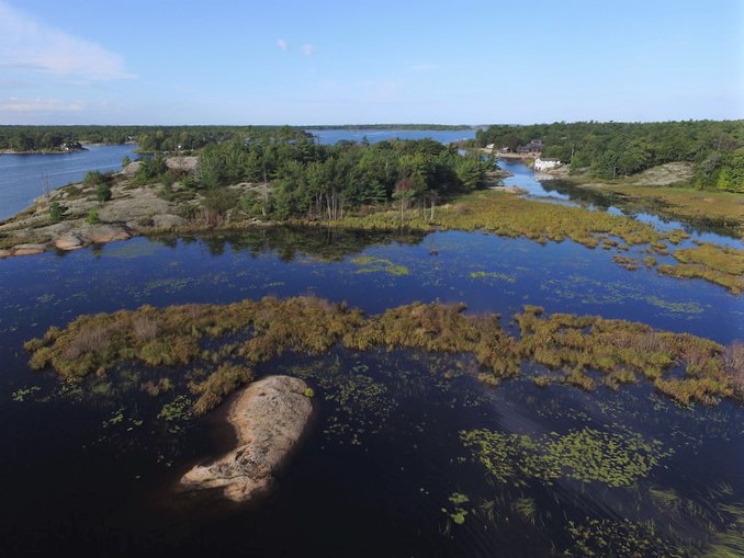
Wetland – Waterbody Edge Complexes
This focus stems from the recognition that wetlands often do not function as individual units, but rather as part of larger, hydrologically-connected wetland systems, where connectivity is an integral part of the overall function.
This layer shows these connections and maps the wetland complexes that exist in the eastern Georgian Bay area. It also maps recommended buffer zones around each complex, which if protected would allow the entire wetland complex to function as an unfragmented unit.
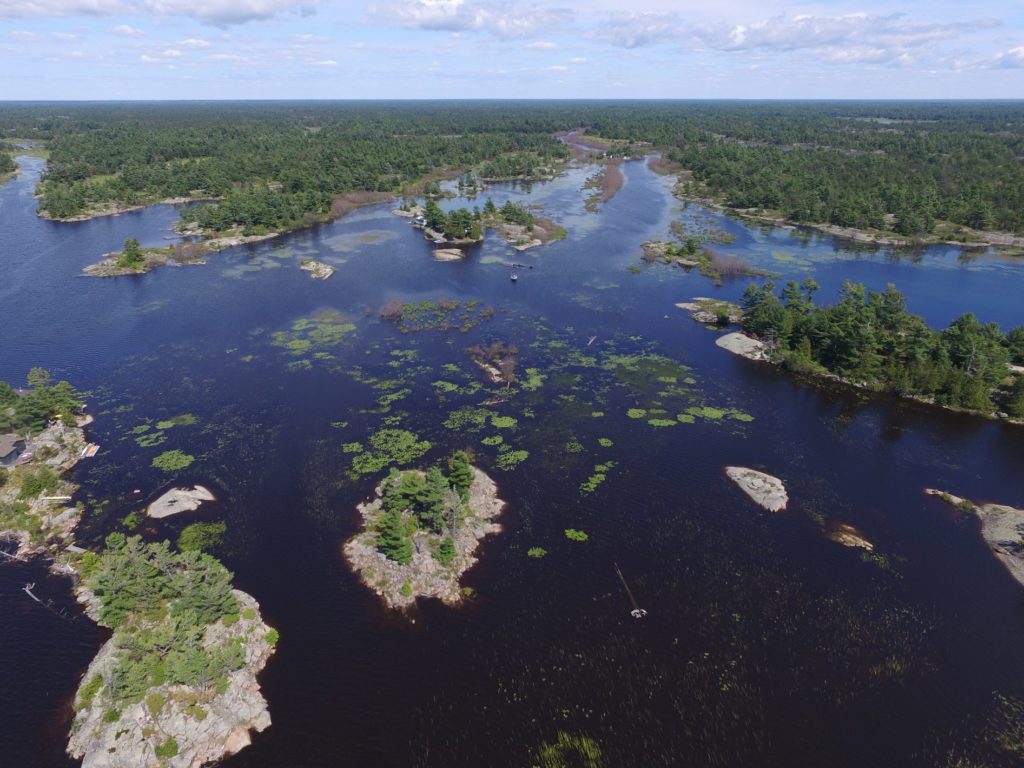
Archipelago Island Complexes
Similar to wetlands, the ecological function of an island is determined not only by its own attributes, but by the larger system within which it exists. Many of Georgian Bay’s small islands support a large amount of life because they are part of island groups that contain a variety of land and shoreline habitat.
This layer categorizes islands based on their size, ecosystem type, biodiversity, number of proximal islands, island density, physical diversity and amount of disturbance in the complexes of which they are a part. This allows the user to put each island into context, and better understand those islands most likely to be rich in life and critical for conservation.
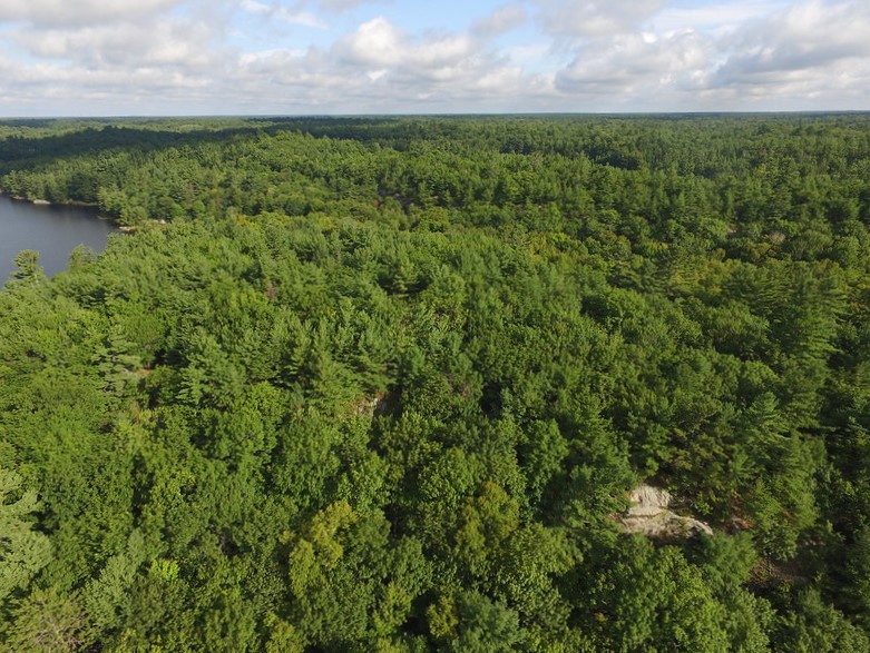
Forest Ecosystem Complexes
The forests along the eastern coast of Georgian Bay are diverse. Within this region, the southern hardwood forests transition to the northern boreal forests. As a result, there are areas of deciduous, coniferous, and mixed forest all within the Biosphere region. These forests play an important role in nutrient cycling, carbon storage, and as habitat for many species.
This layer maps the different types of forest ecosystems in the project area, and ranks them based on size and habitat diversity. It will help assign conservation priority to different forested areas.
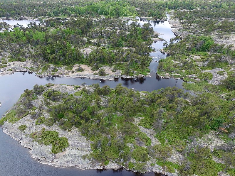
Rock Barrens
Rock Barrens are an important habitat in the eastern Georgian Bay ecosystem, and are one of the reasons this area is home to the highest diversity of reptiles and amphibians in Canada. Many of the region’s at-risk reptiles depend on rock barrens for thermoregulation, and benefit from the habitat mosaic that situates these key warming areas beside equally-important wetlands.
This layer maps eastern Georgian Bay’s rock barrens and their connectivity with other habitat types, helping to identify areas that contain all the necessary habitat for target species to thrive.
Alongside these habitats, the project is creating several other map layers that help to situate land parcels in context:
Existing Protected Areas
The protected areas layer shows all National and Provincial Parks, Conservation Areas, Areas of Natural and Scientific Interest, Provincially Significant Wetlands, and properties protected by the Nature Conservancy of Canada and the Georgian Bay Land Trust. By combining this with the other layers, it is possible to see where key habitats are currently protected, and identify other significant habitats that either border or connect between existing protected areas. These habitats may be prioritized for conservation so that protected corridors are formed.
Species at Risk Habitat
These layers map probable habitat use by each individual at-risk species in the region, based on the key habitats identified in their recovery strategies. This allows users to see which areas any species is likely to depend on, and which species are likely present in any given area. Users can also combine these layers to identify places that provide essential habitat for multiple species at risk, which may be prioritized for conservation.
Threats
Final mapping layers track various threats to species at risk, including existing and planned roads, existing and planned housing and commercial development, wind farms, forest harvesting, invasive species, flood risk, seasonal drought, pollution, climate change impacts, and more. These can be used to understand where mitigation measures would be helpful to species, and to prioritize key places where conservation could prevent some threats from materializing.